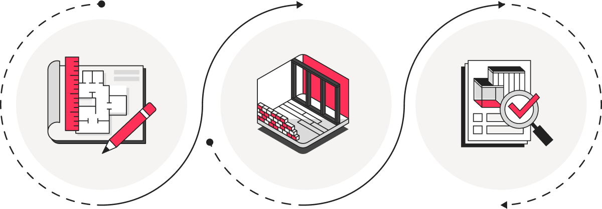
Unleash the Power of Reality Capture
Say goodbye to manual site measurements and traditional surveying


Are Manual Measurements Slowing You Down?
Say goodbye to time-consuming manual measurements and site surveys. Our reality capture services offer precise 3D scanning and drone mapping, enabling you to gather accurate data quickly, efficiently often more affordable than traditional methods.

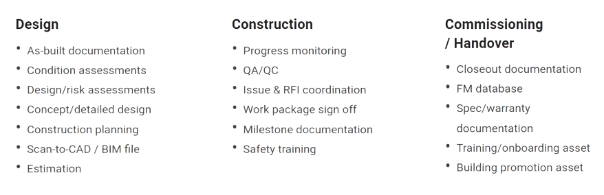
BASIC
- Drone Imagery & Metadata
- Roof Report & Measurements
- 360° View Assessment
- Scaled Top-Down Site View
- Horizental Elevation Profile
- Digital Surface Model (DSM)
- Digital Terrain Model (DTM)
- 24 Hours Turnaround
ADVANCED
- 3D Scan Data
- 360° Site Documentation
- 3D Interactive Virtual Tour
- Built-In Floor Plan
- Built-In Collaboration Tools
- Before-After Comparison
- Schematic Floor Plan (PDF)
- LOD 200 BIM file (IFC)
- 50mm Accuracy* Point Cloud
- 48 Hours Turnaround
COMPREHENSIVE
- Detailed Feature Level Survey
- 3D Scan + Drone Full Dataset
- 360° Site Documentation
- 3D Interactive Virtual Tour
- Built-In Floor Plan
- Built-In Collaboration Tools
- Precise Floor Plan (DWG)
- Sections/Elevations (DWG)
- Aerial Image CAD Overlay
- Geo-Referenced Orthomosaic
- Datum GDA2020/AHD
- LOD 350 BIM file (IFC)
- 10mm* Accuracy Point Cloud
- “As you wish” Turnaround
* We offer a range of 10mm to 50mm accuracy including LOD 200 to 350 depending on the project size, location, capture technology used to collect and process site data and control points. Ref: https://bit.ly/45795wx

Collaboration made seamless
Architects, engineers and construction professionals and contractors can access detailed digital twins, fostering seamless collaboration. Make informed decisions in and keep everyone on the same page.
Boost accuracy and speed
Embrace the precision of LOD 200/300/350 reality capture, ensuring accurate measurements, existing conditions and as-built documentation. Identify costly errors often times and times quicker than traditional methods of measurement.
Key Advantages
360° Virtual Inspection
Experience all-encompassing views of your site within 10-50mm accuracy*, including inaccessible or high risk zones
Time & Cost Savings
Identify potential issues early, optimise timelines and avoid rework to unlock cost and time savings
Seamless Collaboration
Utilise notes, multimedia tags and direct email notifications to promote transparency and proactive communication
Bidding & Induction
Easily share your digital twin with staff, contractors and visitors
Measure, document and collaborate with unmatched 3D visual clarity
Future AI-based AEC
Bid farewell to outdated methods and embrace the potential of reality capture services. Our qualified capture technicians will revolutionise your projects, fostering collaboration and maximizing efficiency. Once you have enough number of models/sites captured, you will be ready to implement AI-based tools to automate clash detection, progress reporting, real-time updates and much more …